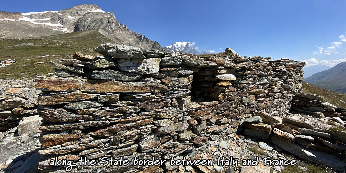
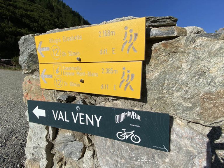
Elisabetta Refuge 2.195 m. – La Casermetta 2.365 m. – Col de La Seigne 2.512 m. (Italy – Upper Val Veny) we cross landscapes of unique beauty; a trekking route that unfolds in the Upper Veny Valley, accompanying us to the state border and then to the gateway to France
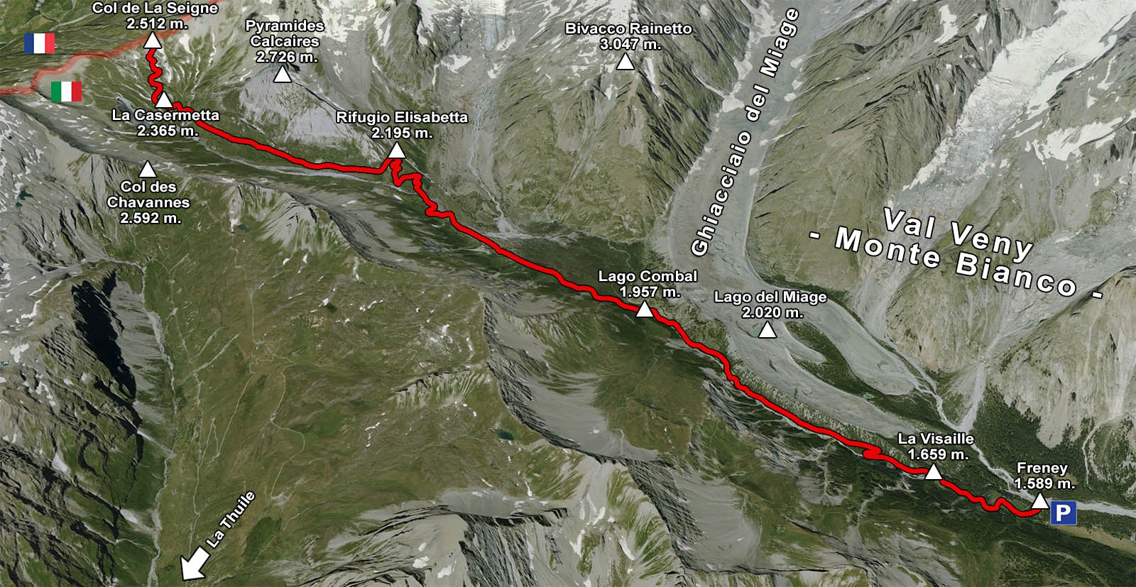
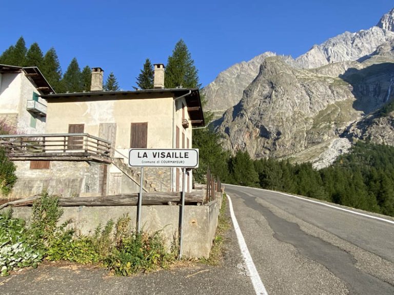
Starting location: Freney 1,589 m. (Val Veny) the starting location is actually La Visaille 1.659 m. but I found the road closed to vehicular traffic by ordinance of the municipality so I had to stop at the hamlet first (about 20 minutes more walking at a brisk pace to get to La Visaille) End point: Col de La Seigne 2.512 m. (Val Veny – Mont Blanc) 1st intermediate point:Combal Lake 1.957 m. 2nd intermediate point: Rifugio Elisabetta Soldini Montanaro 2.195 m. 3rd intermediate point: La Casermetta 2.365 m. Departure altitude: 1.589 m. Arrival altitude:2.512 m. Height difference: 923 m. Location:upper Val Veny, on the state border between Italy and France Difficulty: E [difficulty scale] Hours: 3h 30 minutes for the ascent from the hamlet of Freney, to the arrival at Col de La Seigne Approximately 3h 10 minutes for the descent, which takes place along the same route as the ascent Period: from early June (subject to careful verification of snow conditions), to mid-October Equipment required: classic trekking equipment Signage: TMB Waste: here’s what you need to know before abandoning it
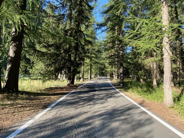
the section of paved road in the Freney area
arriving at La Visaille
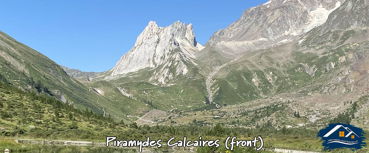
after about 40 minutes, here are the Pyramides Calcaires
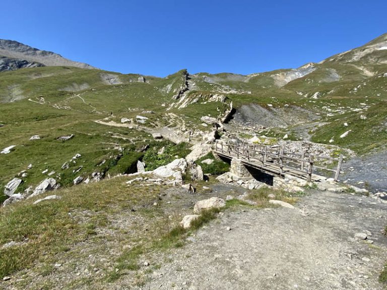
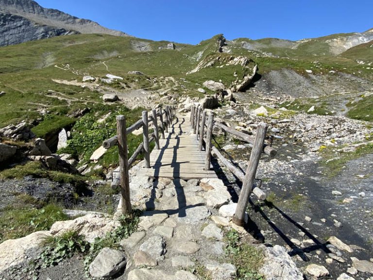
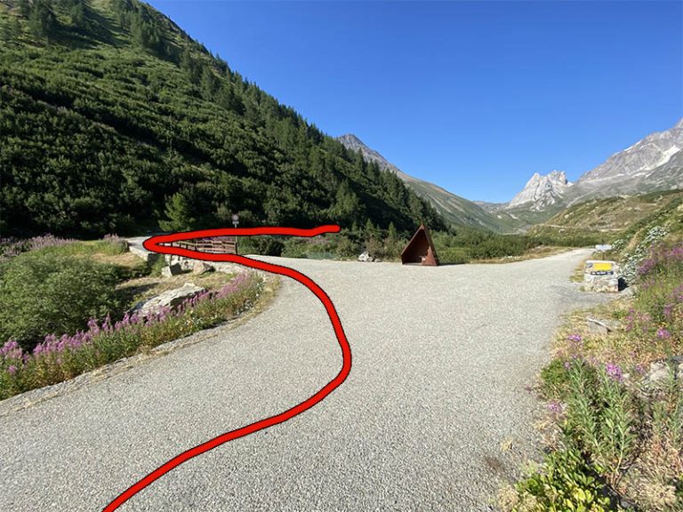
at the Combal Lake bridge take a left
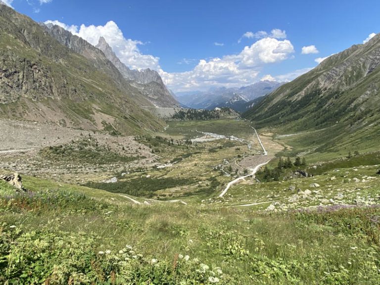
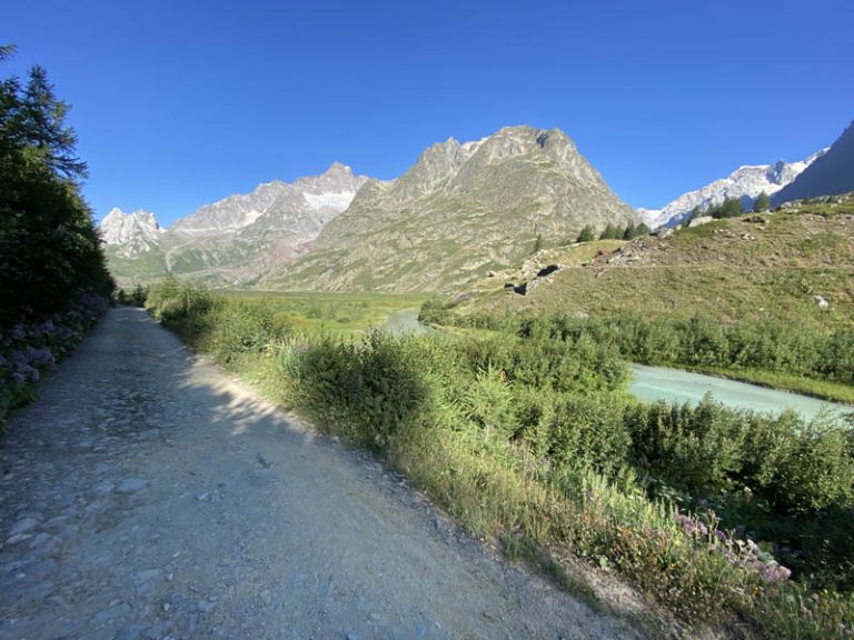
The trekking route I am going to take today, crosses part of the Upper Val Veny and will take me to the state border between Italy and France. A long loop in a grandiose environment, passing through three intermediate points: first Lake Combal, then the Elisabetta Refuge and just before arriving at Col de La Seigne, we will find La Casermetta. Ahead of us, in a well-fronted position are the Piramydes Calcaires, and as we progress along the route, we will find them at our side, only to see them from behind once we reach our destination. I will now share with you the details of this great hike. Val Veny is one of the most beautiful valleys in the entire region, but it is only accessible for a few months of the year. In fact, in the period between November and May, it is impossible to get to these places. The road from Courmayeur that one has to drive to La Visaille is closed and impassable, submerged in snow, as well as dangerous because of the real risk of avalanches. So we are talking about a valley that is closed and unreachable for about 6 months of the year, and this also has its charm,because no one can know and see what happens in these places in the long winter. We can only imagine… It is an early morning of a beautiful late July day, fabulous weather. Via the SS26 highway I reach Courmayeur, which I pass going in the direction of Mont Blanc. Before arriving at the two avalanche tunnels, we find on the left the junction for Val Veny, which we will take. Impossible to make a mistake, the road going up into Val Veny is only one and you have to follow it all the way to the bottom arriving at La Visaille, where beyond you cannot go. We are talking about a paved, well-maintained road with several hairpin bends that goes through campsites and pine forests. In my case, I had to stop and park at the hamlet Freney, (the hamlet before La Visaille). An ordinance of the municipality does not allow to continue further with the car to avoid clogging. No problem, we find ample parking spaces in Freney. However, one has to factor in an extra 20 minutes of paved road to walk and uphill to get to La Visaille, which would be the real starting point of our hike. I set off through a dense larch forest, reach La Visaille and continue for about 45 minutes in total on an asphalt road. Path that I follow until I arrive near a small concrete bridge that I cross by turning left and following the signs for Rifugio Elisabetta.
the signs near the small bridge
the farmstead leading towards the Elisabetta Refuge
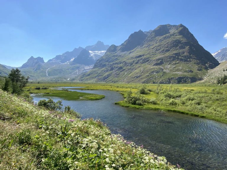
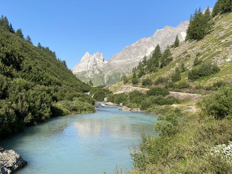
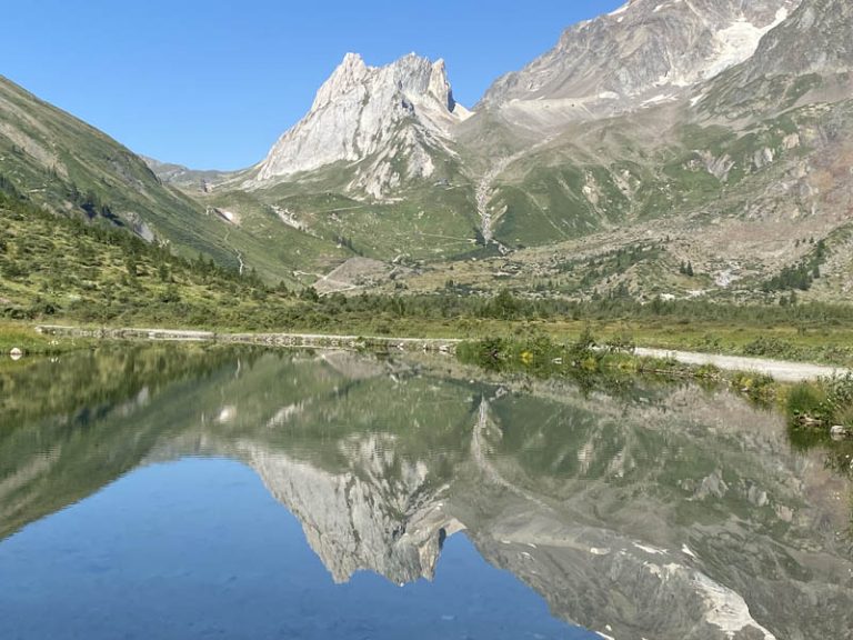
Combal Lake in which the mountains are reflected
a look back with the Aiguille Noire de Peuterey
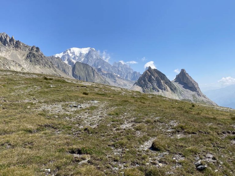
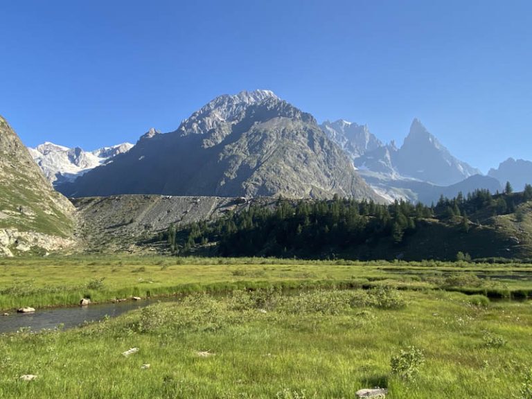
Ahead of us are the spectacular Piramydes Calcaires. Here begins a straight stretch of farm road that partly skirts the Combal Lake, a crystal-clear body of water in which the surrounding peaks are reflected and which widens between verdant turfs of grass. A backward glance delights us with a magnificent part of the Mont Blanc range, where the Aiguille Noire de Peuterey 3.773 m. and the long moraine of the Miage glacier and lake stand out among them all.
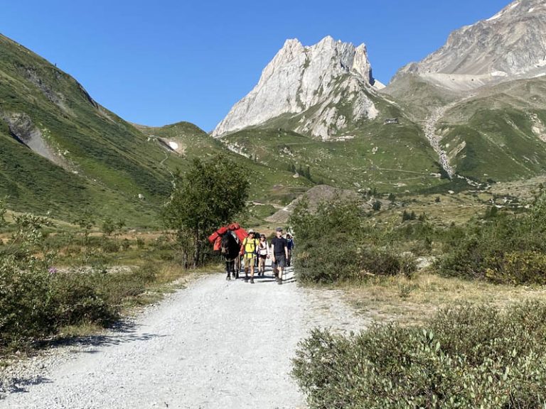
some people have equipped themselves with the mule……
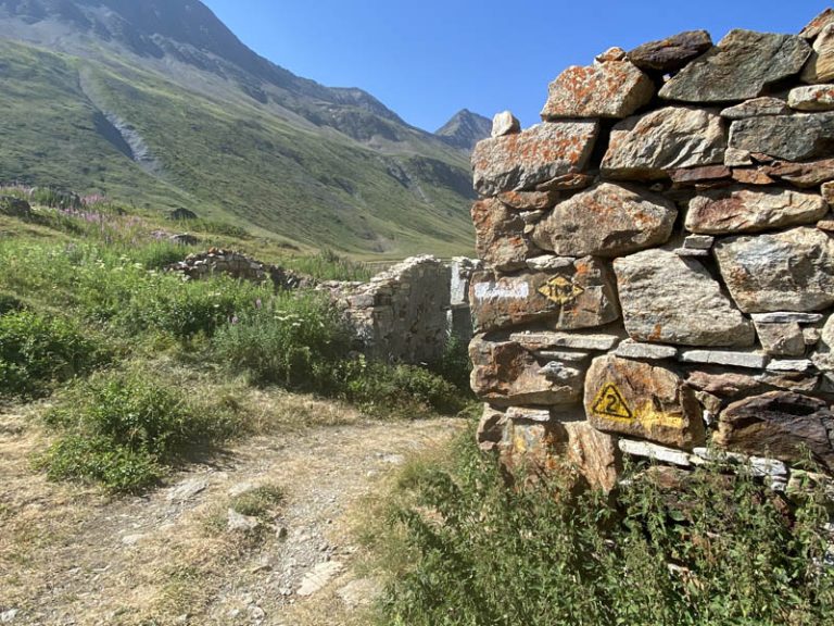
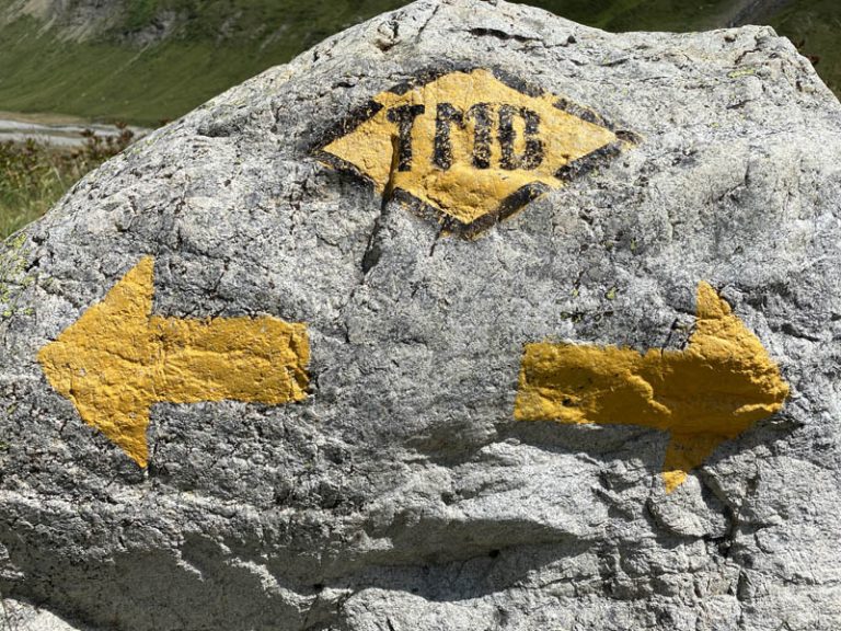
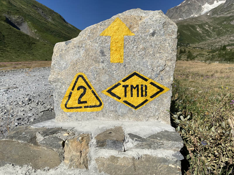
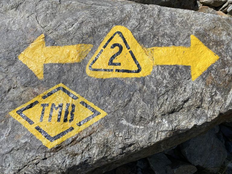
the marker that we are going to follow for the entire route
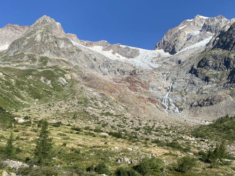
beautiful glaciers, but in severe retreat, we have lost almost 50 percent
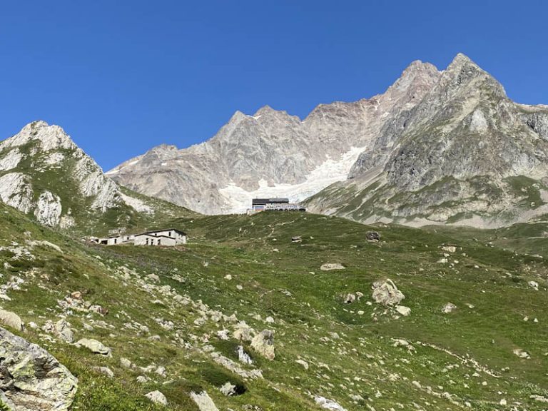
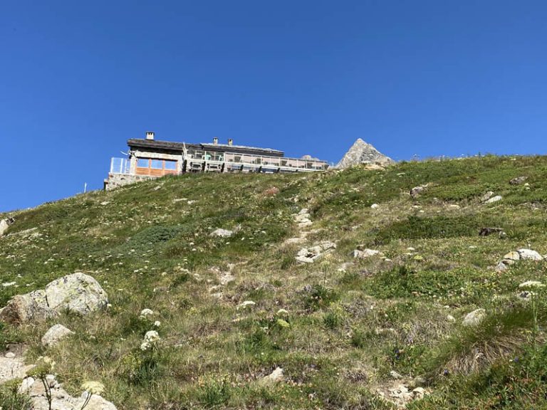
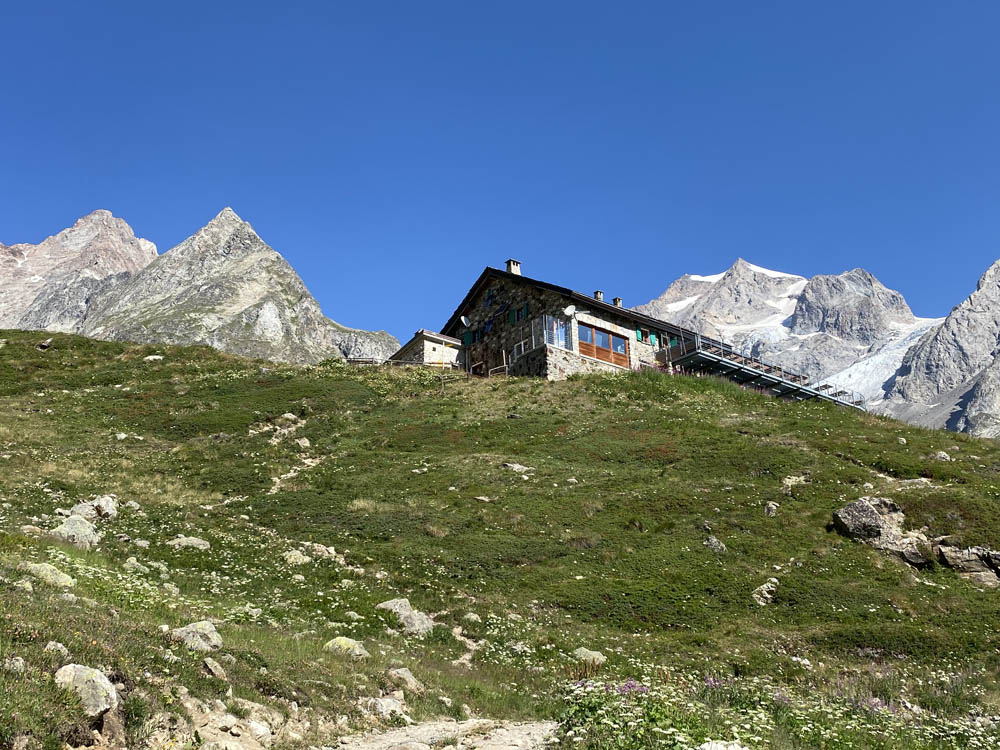
the Elizabeth Shelter already visible from the farmstead
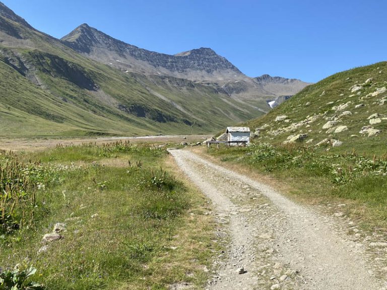
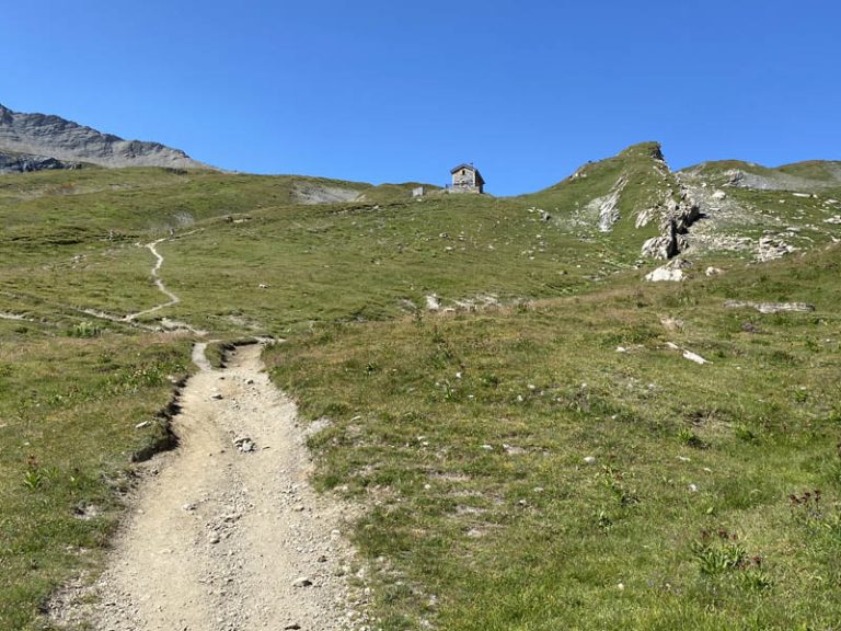
We continue on the farm road catching a glimpse of the Elisabetta Refuge on the horizon, definitely higher up, while on our right we will have the Estellette Glacier and the Lex Blanche Glacier. After walking for about 20 minutes on the farm road, we find a path where, if we wish, it is possible to “cut the farm road” going up it and taking us near the Elisabetta Refuge.
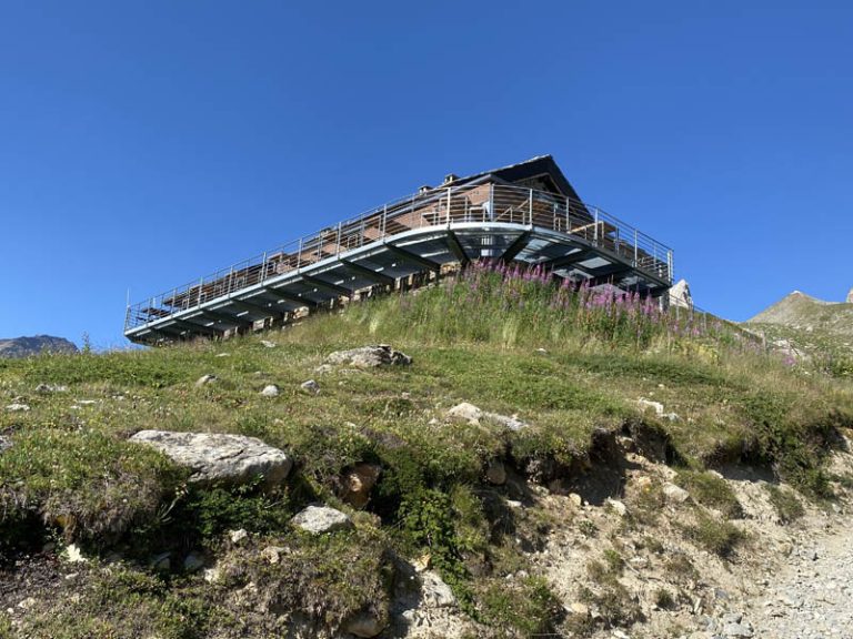
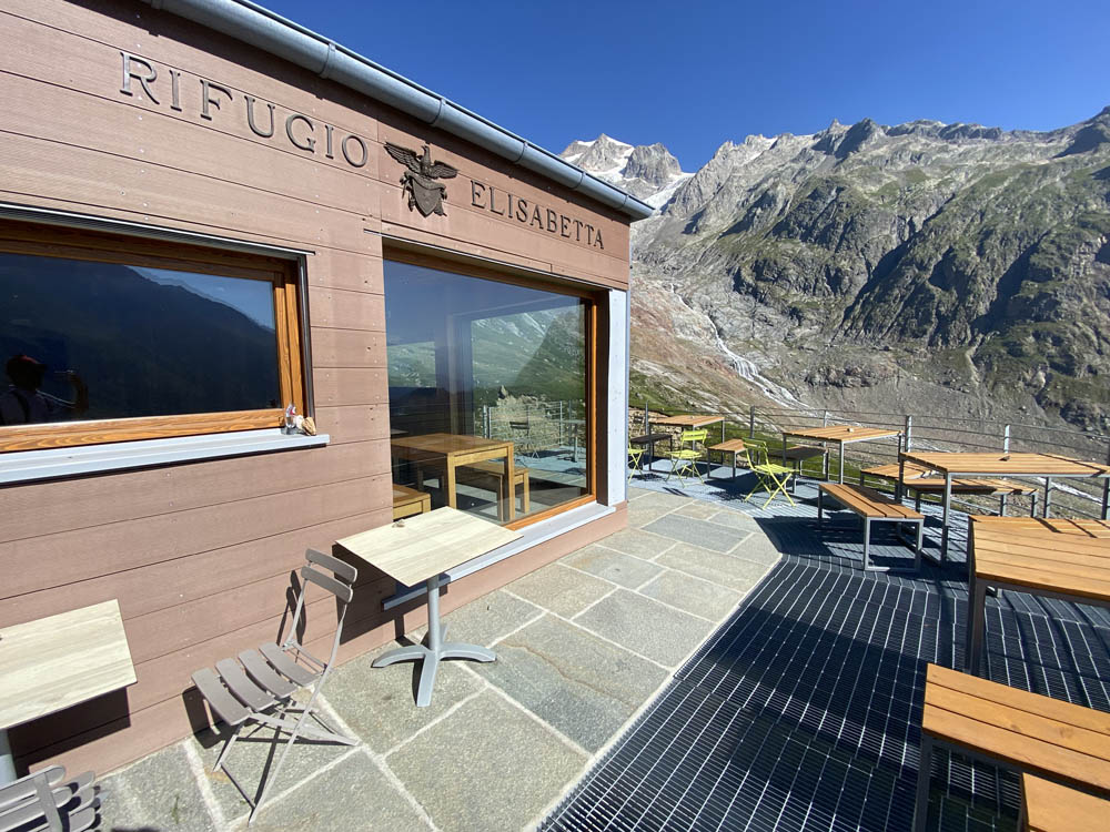
arriving at the Elizabeth Shelter
here we are basically under
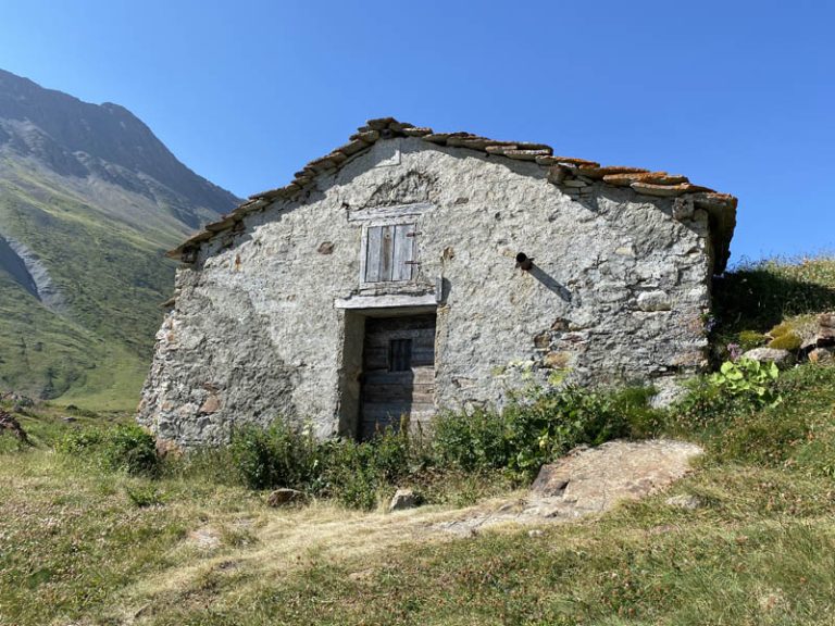
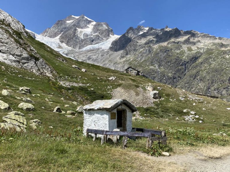
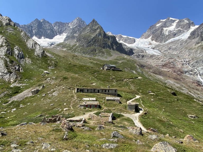
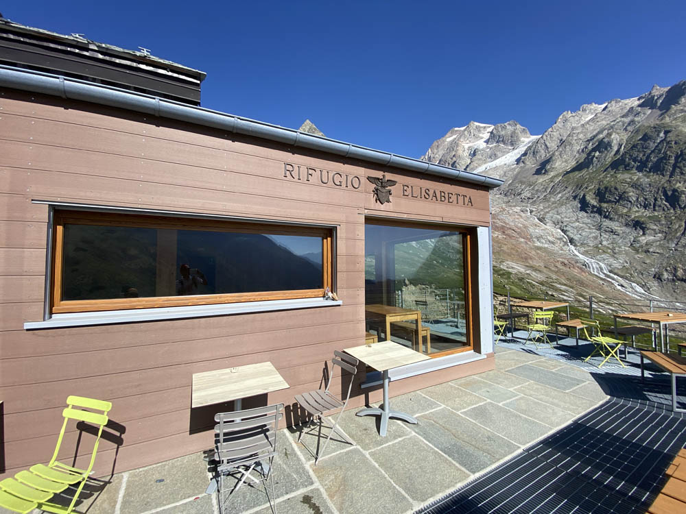
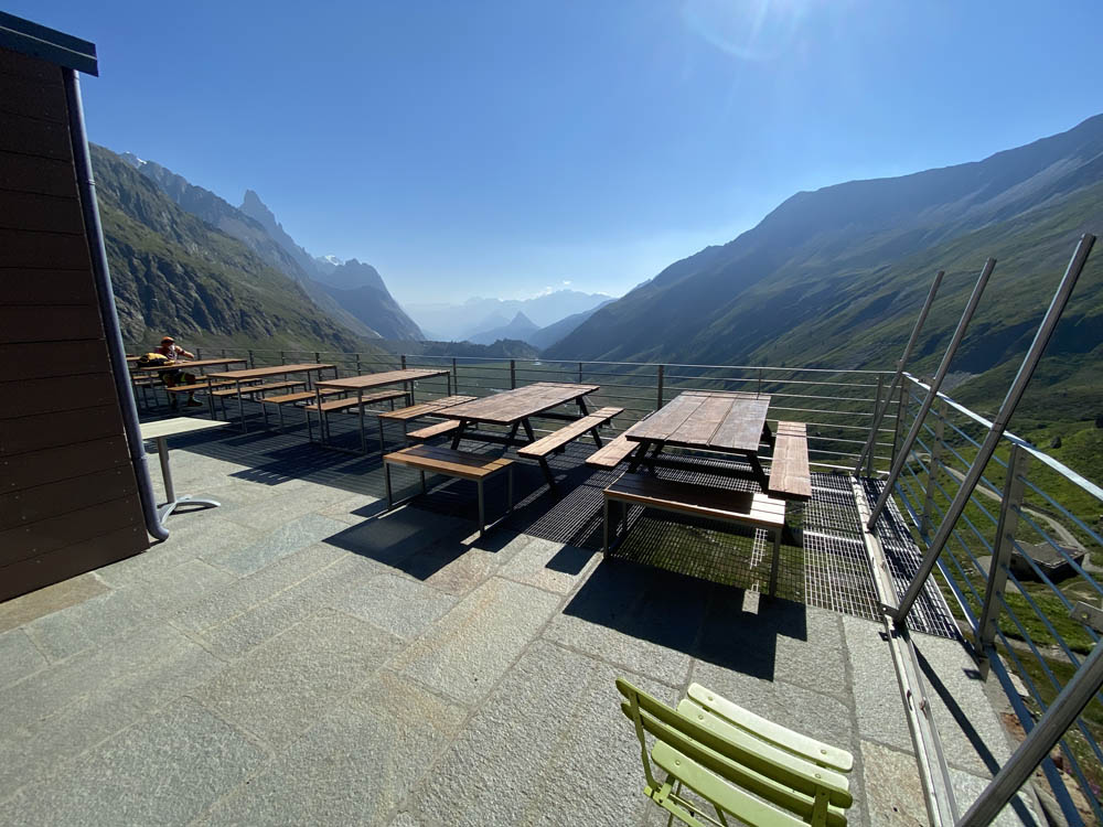
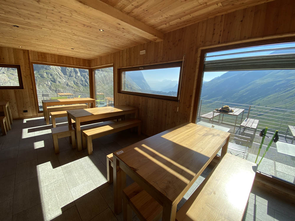
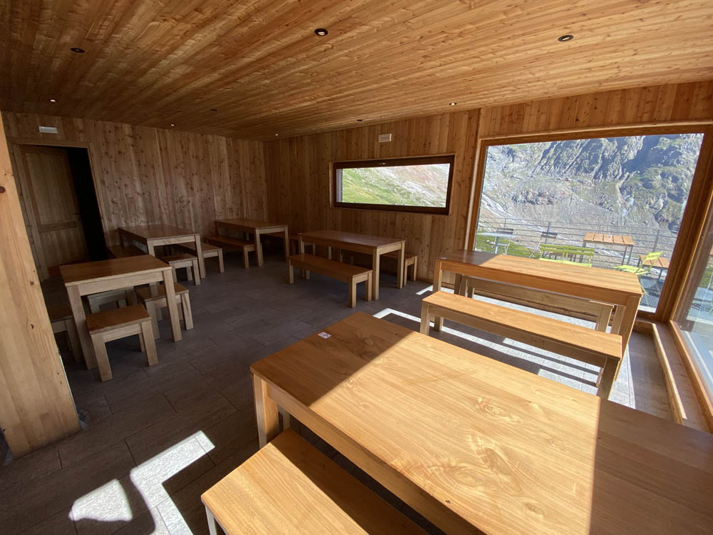
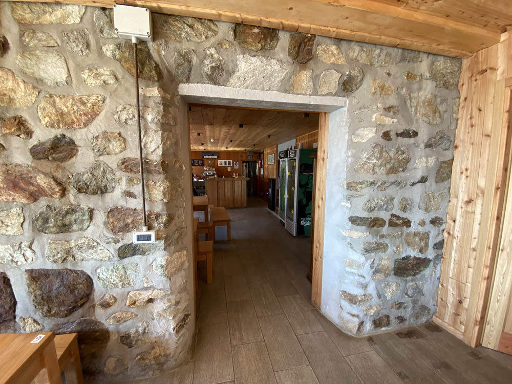
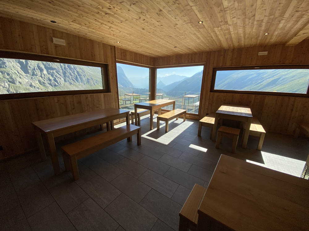
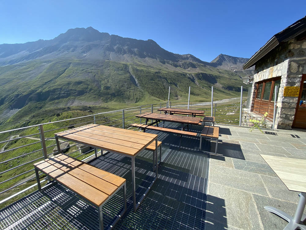
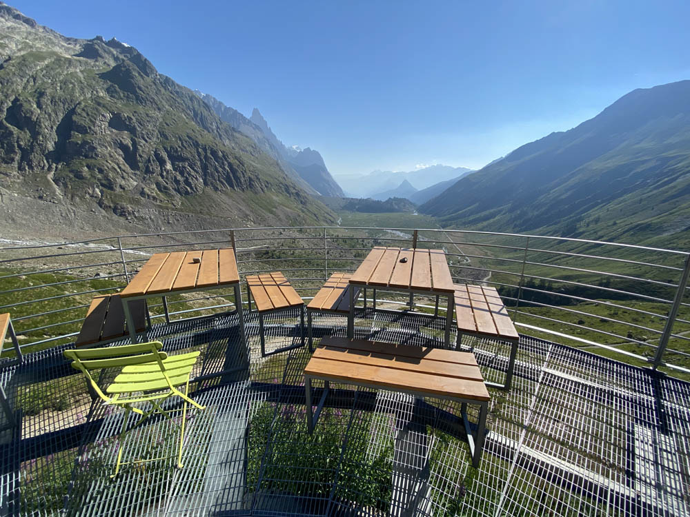
Elisabetta Refuge (which I went to see by making a 5-minute detour from the trail that continues to Col della Seigne), is a beautiful structure recently renovated after being partially damaged by an avalanche in the year 2019. We are talking about a refuge located in one of the most spectacular and wild corners of Mont Blanc, along the Alta Via n° 2, with about 70 beds available. The outdoor terrace is very beautiful, truly spectacular with several tables and benches to fully enjoy the view. Inside, we find two large rooms, both wood-beamed, with large windows that allow an enchanting view of Mont Blanc and the “lower” part of Val Veny. The decor consists mainly of elegant wooden tables and benches, where you can enjoy excellent cuisine with unforgettable views. From the Freney parking lot to the Elisabetta Refuge, we have to consider a walking time of about 2 hours.
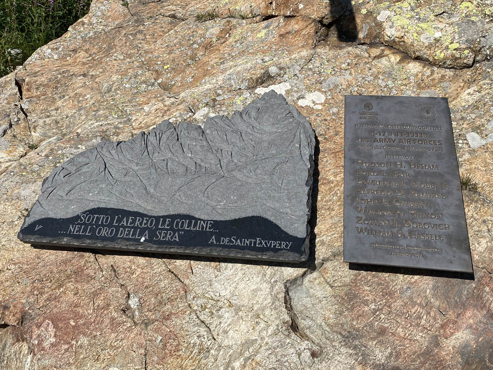
Near the refuge, we find the plaque commemorating the crew of an American B17 Boeing warbird. On the night of November 1, 1946, with bad weather conditions, taking off from London and heading for Corsica, the Boeing B17 never reached its destination, crashing into the summit of the Aiguille des Glaciers, the last peak before the French valleys and thus of a lower and easier to follow air corridor. It seems that the crew, confused by the blizzard and in the absence of landmarks, lost their course, crashing into the mountain’s summit and shattering into a thousand pieces. Off course, with no direct witnesses and no radio contact, the crew was given up as missing for a long time. Only these mountains (if they could speak), could tell precisely what happened that night. We can only speculate.
near some huts just below the hut
going to take the path
the farm track that climbs from the Elisabeth R. to the Col de La Seigne
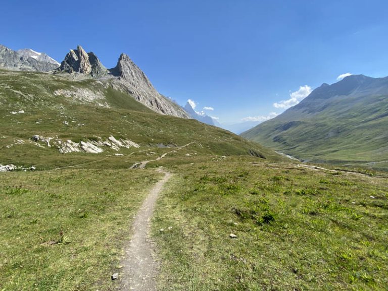
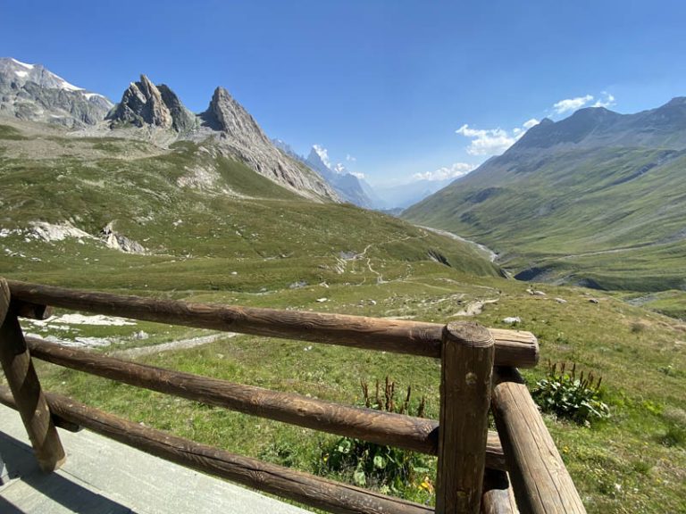
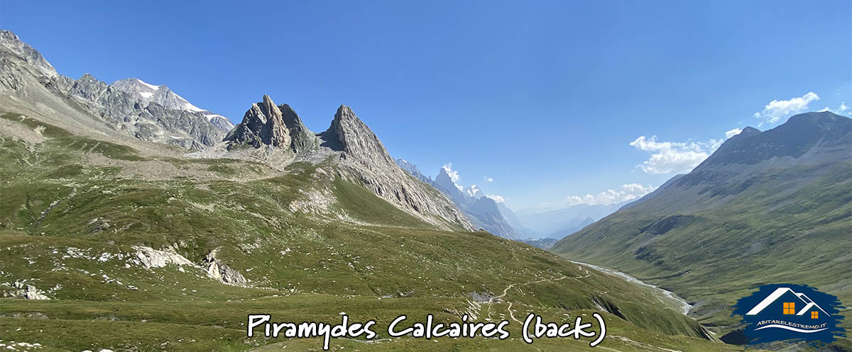
on the right the Pyramides Calcaires, on the left the Col des Chavannes
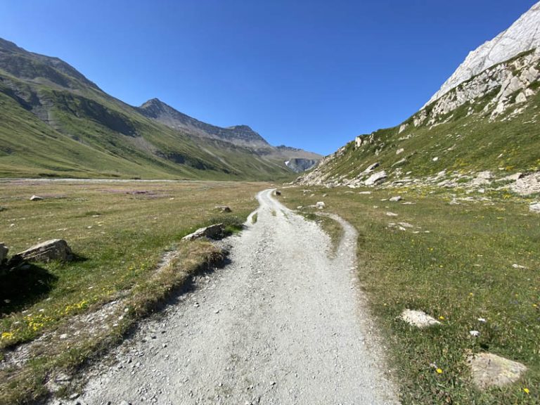
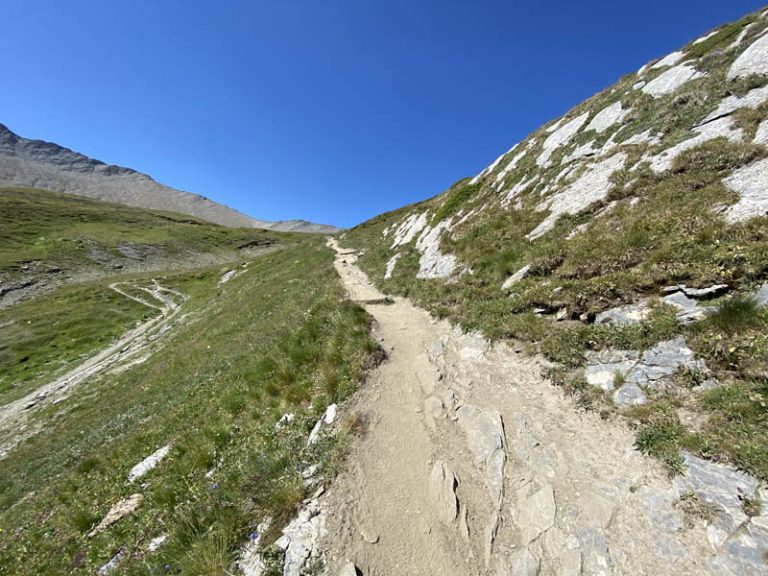
After a short stop, I continue following the path marked “TMB” (Tour del Mont Blanc), and I set off along a farm track that enters a very wide valley that after about 10 minutes begins to climb. On our right we have the walls of the Piramydes Calcaires, while on our left we find the ascent path that heads towards the Col des Chavannes, we continue keeping in the center of the valley. The wide path we are taking is very well marked, clear, and easy to access.
toward the end of the farmstead
the small bridge that closes the farmstead and opens to the trail
a glance ahead to La Casermetta
and a look back
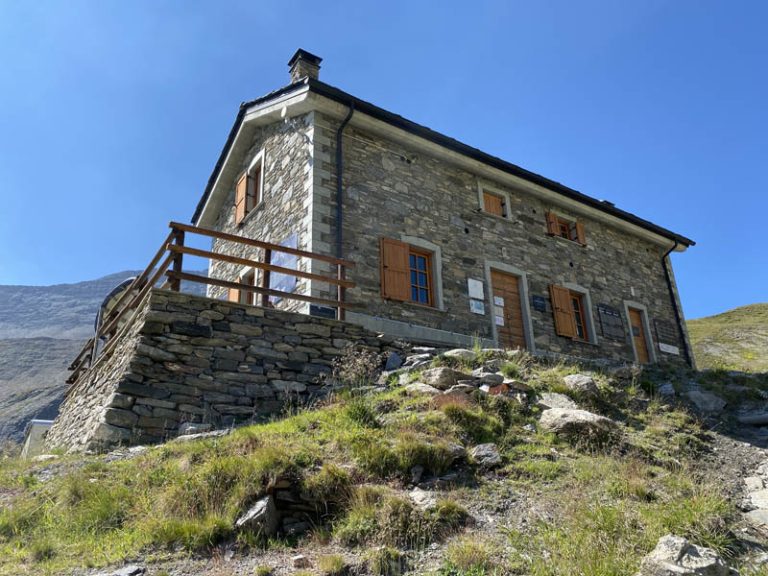
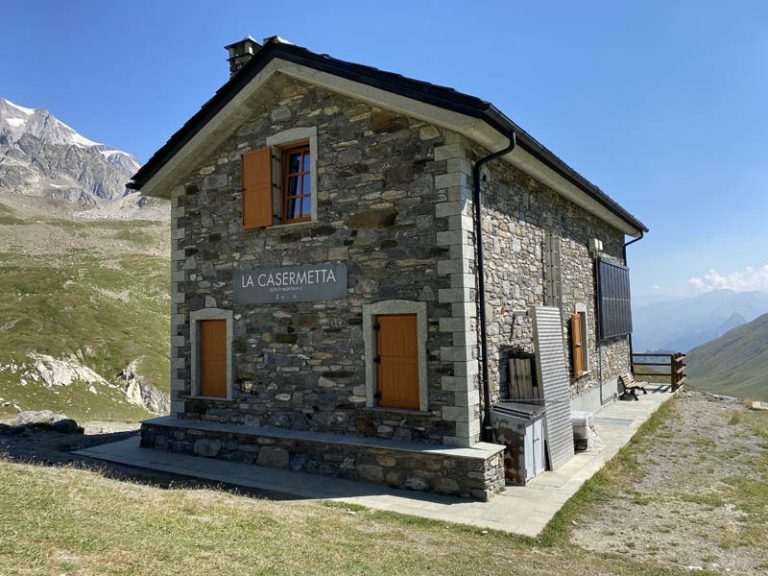
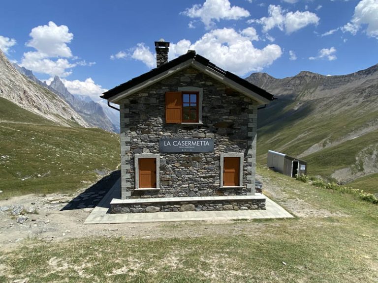
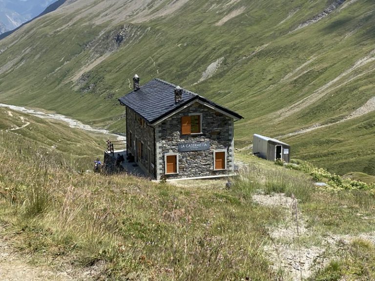
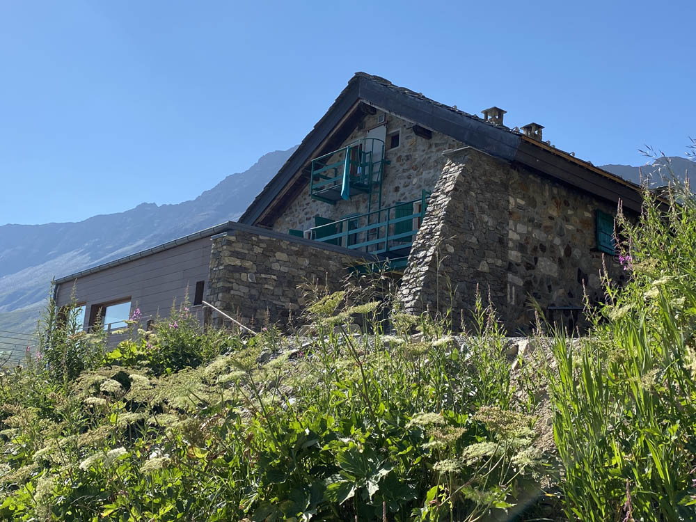
After walking for about half an hour along the farmstead, we arrive near a small wooden and stone bridge, which we cross and begin to climb further up the path that takes us in the direction of the Casermetta, from this point already clearly visible. The Casermetta was once a military structure bearing witness to the difficult coexistence between nations, particularly during World War II. Renovated after the year 2000 thanks to a European grant and funding, it now has an energy supply system based only on renewable sources, with photovoltaic solar panels and a micro hydroelectric power plant. In just over 10 minutes after crossing the bridge we find ourselves on the terrace of the Casermetta.
arriving at the barracks
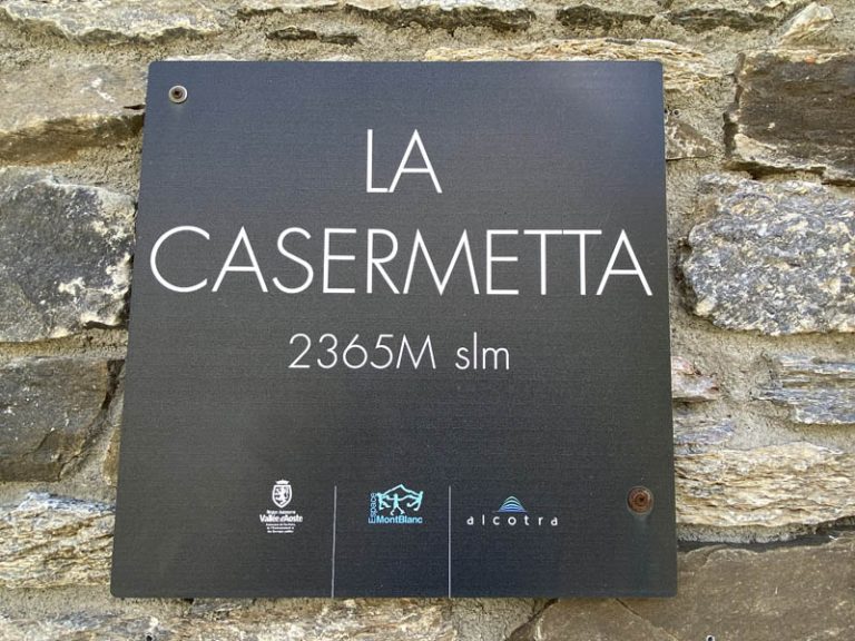
La Casermetta
the license plate
the Casermetta seen from the front
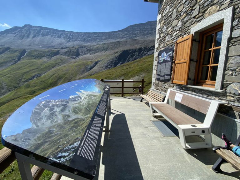
Well, needless to say, the view of the “valley floor” with the various ascent routes we faced, the Mont Blanc chain and later the Piramydes Calcaires on our left and the Col des Chavannes on our right is postcard-perfect. Inside the Casermette we find a small museum, where a lot of interesting information referring to the high mountain environment is illustrated.
view from the terrace of the Casermetta
the panel showing all the peaks around us
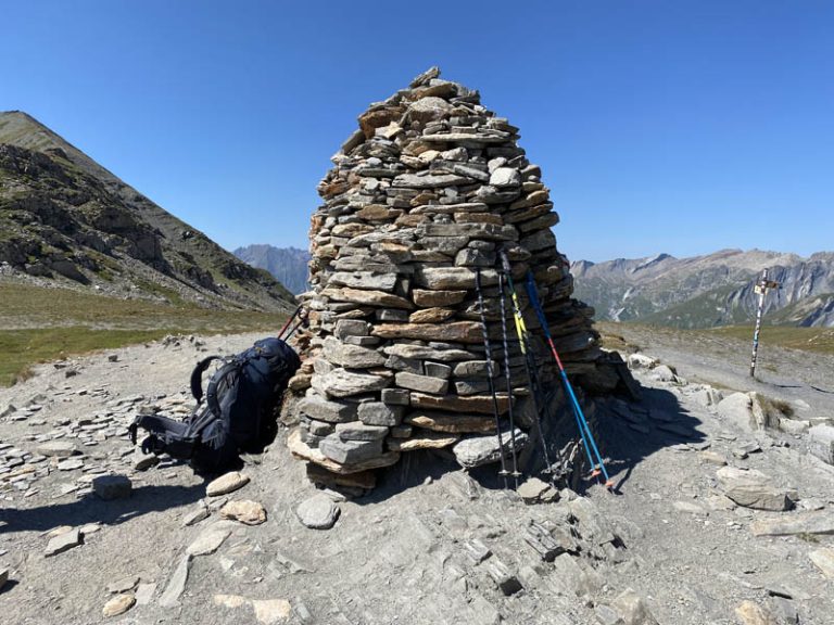
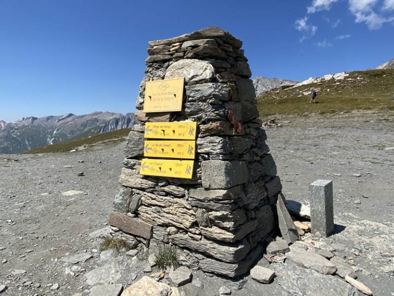
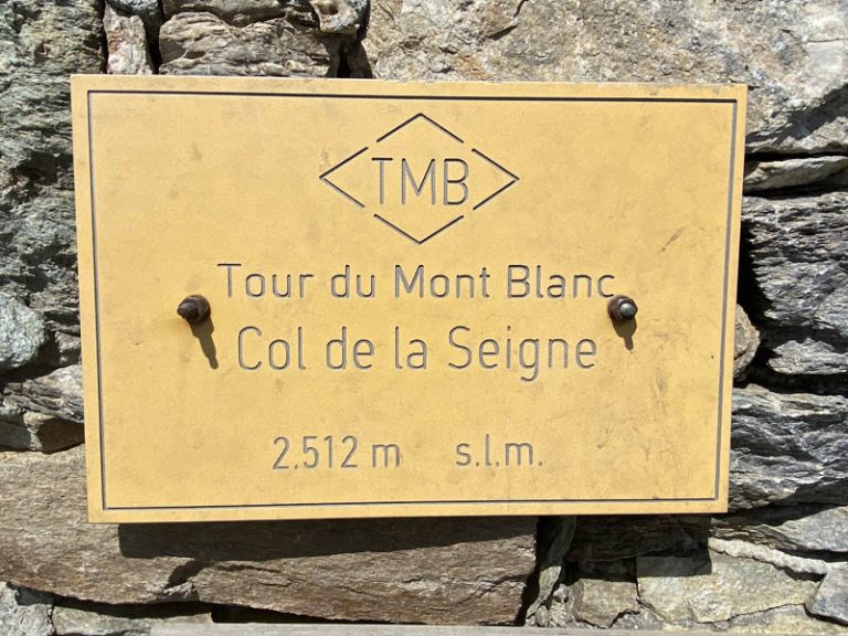
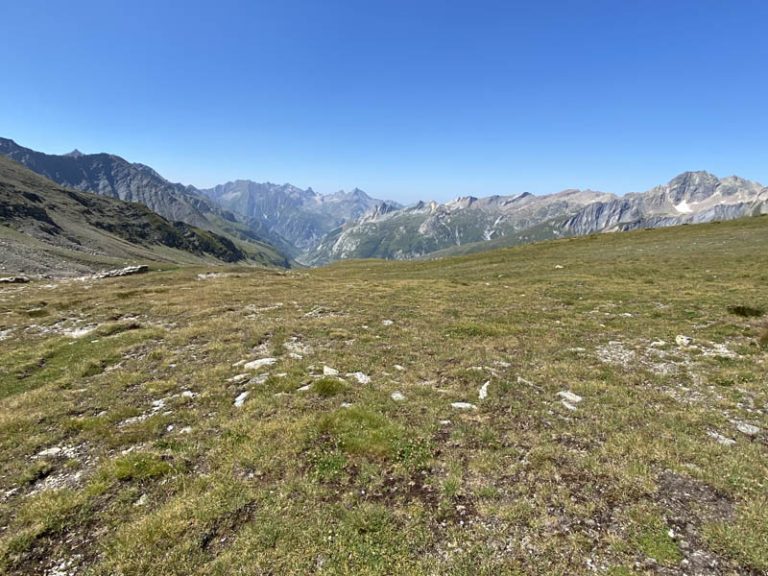
After a stop at La Casermetta, I resume the uphill trail to reach my destination, which I reach in about 20 minutes of walking. A rather large cairn, next to a round wrought-iron board with the names and directions of several mountains on it, seals the arrival at Col de La Seigne, certified by the ever-present summit sign: 2.512 m. I am on the state border between Italy and France. From up here, the view is completely open on both the Italian and French sides with dozens of peaks and ridges on both sides scattering across the horizon. I sit and contemplate a 360-degree opening of extraordinary mountains, and everywhere I look, I am enraptured.
the path going up to the Col de La Seigne
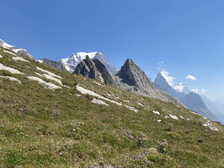
behind me, Mont Blanc popping up between the Pyramides Calcaires
the giant little man with welcome
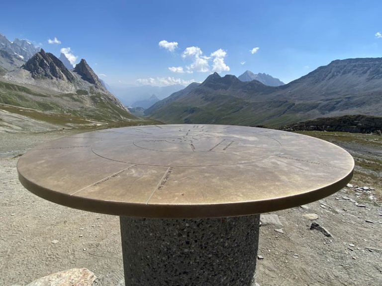
the table with the names of the various peaks
the second cairn with the summit plaque
Col de La Seigne 2.512 m.
From these places, it is easy for me to reason and reflect on the value of life, the importance of knowing how to love what surrounds us, caressing it with my gaze and wishing I could climb these places for many more years. These are hikes that deserve the more than 3h 1/2 of walking and you will be amply rewarded, just as on every occasion, the mountains have the ability to know how to give.
the view from the Col de La Seigne towards France
the view from the Col de La Seigne towards Italy
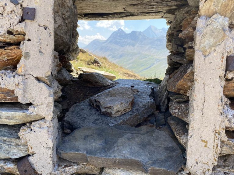
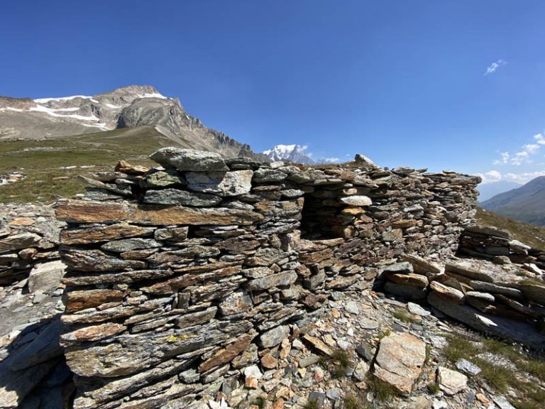
peering through the windows of a semi-destroyed barracks
ruins of old barracks
After a stop at Colle della Seigne of about 2 hours, I reluctantly resume my descent, which takes place along the same route taken earlier. In the descent that first takes me again near the Casermetta, then over the small bridge and arriving after 40 minutes at the Elisabetta Refuge, I hear the many hikers I meet speaking a bit in all languages. Some on foot, some on MTBs, some one way and some the other way, this route is a gateway to the Aosta Valley and Italy by men and women of all nationalities. A great experience. Arriving near Rifugio Elisabetta, I stop once again to admire the place, with glaciers of indescribable beauty although unfortunately in severe retreat. The low snowfall, combined with the great heat, is rapidly taking away very important water heritages. A reflection is in order.
returning from Col de La Seigne towards La Casermetta
near the Elisabeth Shelter
a look toward the valley floor
today’s marker
From the Elisabetta Refuge, we descend the farm track that will take us on a long straight stretch near Combal Lake. Turning back with nostalgia, we now see again, far away, the Piramydes Calcaires that we had at our side today and then passed to take them back from behind and see them again from the front. What a ride, what magic, what places. The day ends with a view of Combal Lake, nestled among lush green meadows, abutting important peaks that we can safely consider among the most beautiful in the world.
Report and photographs by: Michele Giordano Official translator of abitarelestremo: Andreina Baj
one last look at the Elisabeth Shelter before descending
the photo at the close of the day
Notes: the long route from Freney to Col de La Seigne takes place in a high mountain environment with enchanting landscapes. Places that can only be visited for a few months of the year and are completely inaccessible throughout the winter and much of the spring period. In the ascent, the various intermediate points represented by Combal Lake, the Elisabetta Refuge and later the Casermetta, add grandiose value to a place already spectacular in itself.
Utilizziamo i cookie per essere sicuri che tu possa avere la migliore esperienza sul nostro sito. Se continui ad utilizzare questo sito noi assumiamo che tu ne sia felice.OkNoPrivacy policy

